A Strategic Shift in Spatial Intelligence
Maxar Intelligence, a long-time leader in space-based intelligence, has officially rebranded as Vantor. The rebrand declares a new identity: an AI-driven spatial intelligence company that unifies data across the space, air, and ground domains. With the launch of its Tensorglobe platform, Vantor is positioning itself to move far beyond traditional satellite imagery into real-time, multi-domain sensor fusion and intelligence.
For the national security community, the shift signals new ways to collect, fuse, analyse and deliver data directly to the warfighter and analyst. Rather than providing static snapshots from orbit, Vantor aims to deliver a continuously updated common operating picture that enhances situational awareness across space, air, land, and sea.
From Imagery to Unified Intelligence
The rebrand reflects the company’s accelerated transformation over the past few years. While the company was once defined primarily by its high-resolution satellite imagery, in recent years it has invested heavily in software, analytics, automation, and machine learning. Now, as Vantor, it is driving a fully integrated spatial intelligence grounded in its unmatched global-scale spatial foundation.
Now, Vantor is focused on fusing the 2D and 3D maps built from its satellite imagery to unify data from satellites, drones, and ground assets, creating a foundation to build an always up-to-date Common Operating Picture. Vantor is solving for the biggest problem facing the defense and intelligence community—the proliferation of disconnected sensor platforms across all domains.
The brand itself conveys the company’s mission: to help customers gain a “real-time competitive advantage” by offering total clarity for high-stakes missions.
Introducing Tensorglobe
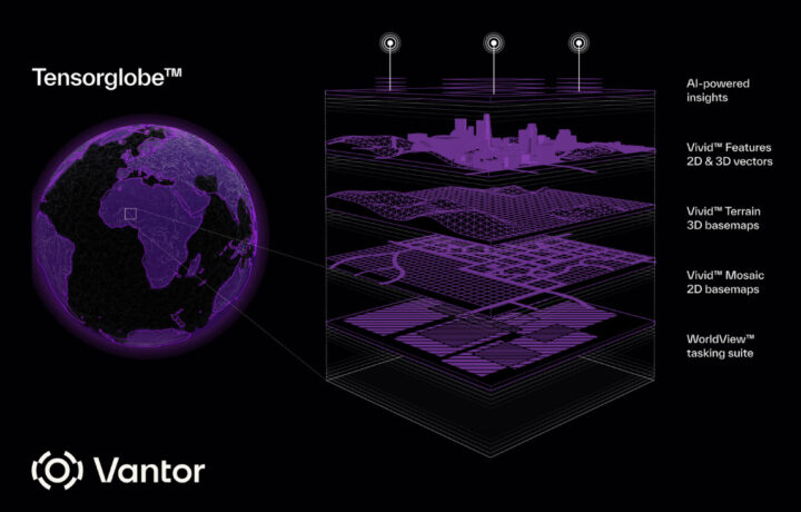
At the heart of Vantor’s strategy is Tensorglobe, an AI-enabled spatial intelligence platform designed to automate the TCPED (tasking, collection, processing, exploitation, and dissemination) intelligence cycle and unify data across space, air, and ground. The platform includes several components:
- Cortex – orchestrating satellite tasking across multiple constellations
- Forge – fusing data from space, air, and ground sensors in real time and automating the production of 2D and 3D maps from that fused data
- Nexus – secure hosting solution to deploy the spatial intelligence to every human and machine in an organization’s ecosystem
With these offerings, Vantor is promising to deliver deeper mission-critical insights to help decision makers act faster and to provide a reliable ground truth that can connect the next generation of autonomous systems.
Looking Ahead
The launch of Vantor reflects a larger shift in the intelligence community: the move from data collection to data clarity and automation. For the cleared community, this evolution is an invitation to prepare for new opportunities—and new challenges—where AI and autonomy reshape the way spatial intelligence supports national security.
Browse Openings at Vantor
Learn More About Vantor
SPONSORED CONTENT: This content is written on or behalf of our Sponsor.


